Water Storage Levels
Last Updated
17/04/2024
| Current Volume |
33143 |
| % of Capacity |
82.04 |
| Capacity (ML) |
40400 |
|
99.5%
|
99.6%
|
91.1%
|
84.1%
|
82.0%
|
| Dec |
Jan |
Feb |
Mar |
Apr |
Facts & Figures
| Name |
Lake Nillahcootie |
| Stream |
Broken River |
| Year of Completion |
1967 |
| Construction |
Earth and Rockfill |
| Full Supply Level |
264.5 m AHD |
| Capacity |
40,400 ML |
| Area Submerged |
530 ha |
| Main Embankment Length |
791 m |
| Main Embankment Height |
34 m |
| Hydro-electric Generation |
nil MW |
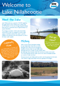
About Lake Nillahcootie
 Lake Nillahcootie
Lake Nillahcootie was constructed to harness the flows of the Broken River to meet irrigation, domestic and stock, and urban water supply requirements.
Location
Lake Nillahcootie is situated on the Broken River in north-eastern Victoria, 36km south of Benalla. The name Nillahcootie is of Indian origin and reputedly means ‘Blue House'.
History
The storage was built in 1967 by the Rural Water Commission as part of a program to assure water supply in northern Victoria.
Operations
Lake Nillahcootie was constructed to harness the flows of the Broken River to meet irrigation, domestic and stock, and urban water supply requirements.
In previous years when Lake Nillahcootie was assured of filling to capacity, water could be released in accordance with a target volume determined for filling Lake Mokoan. This operation optimised water harvesting between the two storages and would normally occur during winter and spring months. With the decommissioning of Lake Mokoan, this is no longer required.
The main spillway at Lake Nillahcootie features a unique Gothic arch-shaped crest that allows the discharge of 117,000 ML/d - equivalent to the volume of an Olympic-size swimming pool passing the spillway every two seconds.
The storage also features a secondary spillway that is operated only during severe floods. It uses the ‘fuse plug' principle, in which a section of earthen embankment within the secondary spillway (the fuse plug) has been designed so that at a predetermined flood level it will be eroded away and increase the discharge through the spillway.
Recreation and Tourism at Lake Nillahcootie
Facilities Available

Large Grassed Area

Car Parking

Boat Ramp

Fishing

Toilets
Please observe all signs and directions around our storages for information on recreational activities. Refer to the Land and On-Water Management Plan (if provided above) for detailed information on the facilities available.
Further Information

Lake Nillahcootie is a popular place for fishing, swimming and boating. It also has excellent picnic facilities and an attractive lawn area near the dam. Access to the Lake foreshore is restricted as most of the land is privately leased. Camping is not permitted around the foreshore of the lake. Picnic and boating areas are open to the public from 8.00am to sunset daily.
Visitors are advised to be aware of the dangers associated with low water levels and exercise caution.
Boat ramp operating levels
This table shows at what level boat ramps at Lake Nillahcootie can be used. The percentage indicates the lowest the storage can get before the ramp becomes unusable.
| Boat ramp |
Operational when storage is above |
| High Level Ramp* |
11% |
*Due to shallow gradient, this ramp may not be suitable for larger vessels at high lake levels.
Lake Nillahcootie Fact Sheet